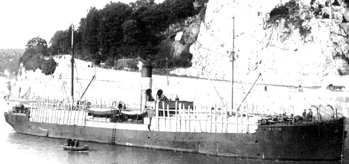
The steel steamship Ruth was launched from the Maryport yard of William Walker (Yard No 92) on 20th February 1908. She measured 160.5′ x 28.1′ x 11.0′ and her tonnage was 576 gross tons, 292 net tons. She was powered by a triple expansion steam engine by Hutson and Sons Ltd., Glasgow delivering 78 registered horse power.
Extract Lloyd’s Register 1942.

Builders long section – Lloyd’s Register
Ordered by W Butler Wang of Tonsberg, Norway she operated for this company until she was sold to Engelbrethsen and Henricksen of Arendal , Norway in 1912. Multiple ownership changes followed until she was acquired by Oscar Emanuelson of Nya Varvet in 1928 who renamed her Ferdiborg. Six years later she was sold again to M Tchetveroukhine and N Difonzo of Antwerp who renamed her Yolande in 1935. Finally she was purchased by the Border Shipping Co Ltd of Aberdeen for operations on the Scottish east coast and North Sea routes who changed her name to Murrayfield.
Steamship Ruth (Skipshistorie.net)
Details of her loss are sparse due to wartime reporting restrictions but, on 7th April 1942, while she was en route from Lerwick to Methil and Newcastle in ballast when she ran aground in fog on the north side of Peerie Bard, Mousa. The crew were able to disembark into the ship’s boats as the sea was calm in the foggy weather. A few hours later the Murrayfield slipped of the rocks and sank.
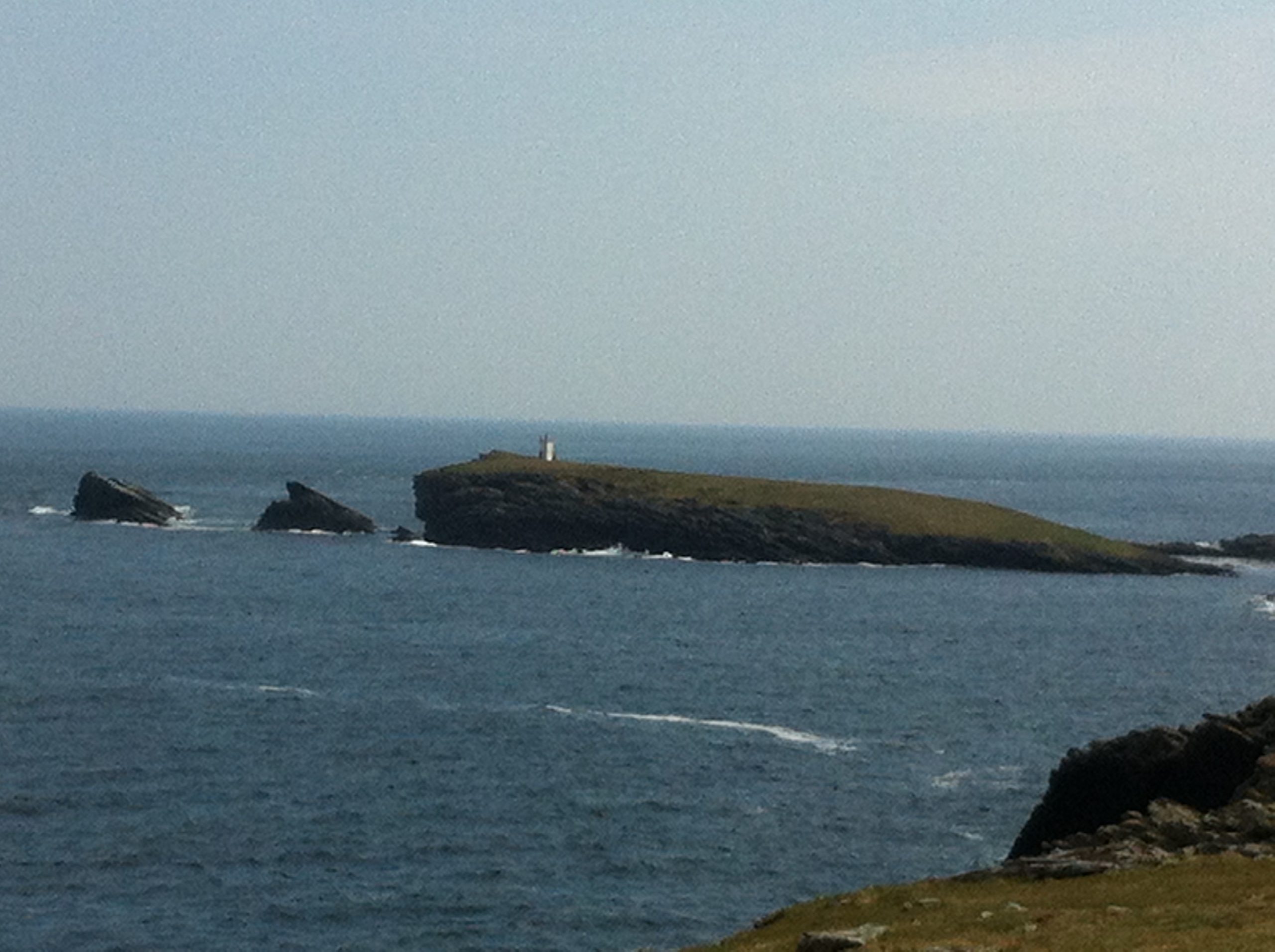
View from north towards Peerie Bard
The wreckage of the Murrayfield was reported by local divers scattered in depths of 5 – 25 metres in the 1980s with enough scattered ammunition visible that they reported it to a Royal Naval disposal team. More up to date diver reports in the early 2000’s reported the wreck broken up with the boiler standing proud of the seabed in approximate position 59° 59.936’N, 001° 09.616’W. There is some scattered wreckage visible ashore near this position which has been attributed to the Murrayfield but we have been unable to verify if this is indeed the case.
We would like to thank Lloyd’s Register Foundation – Heritage & Education Centre for allowing us to reproduce documents from their archive in this article.


