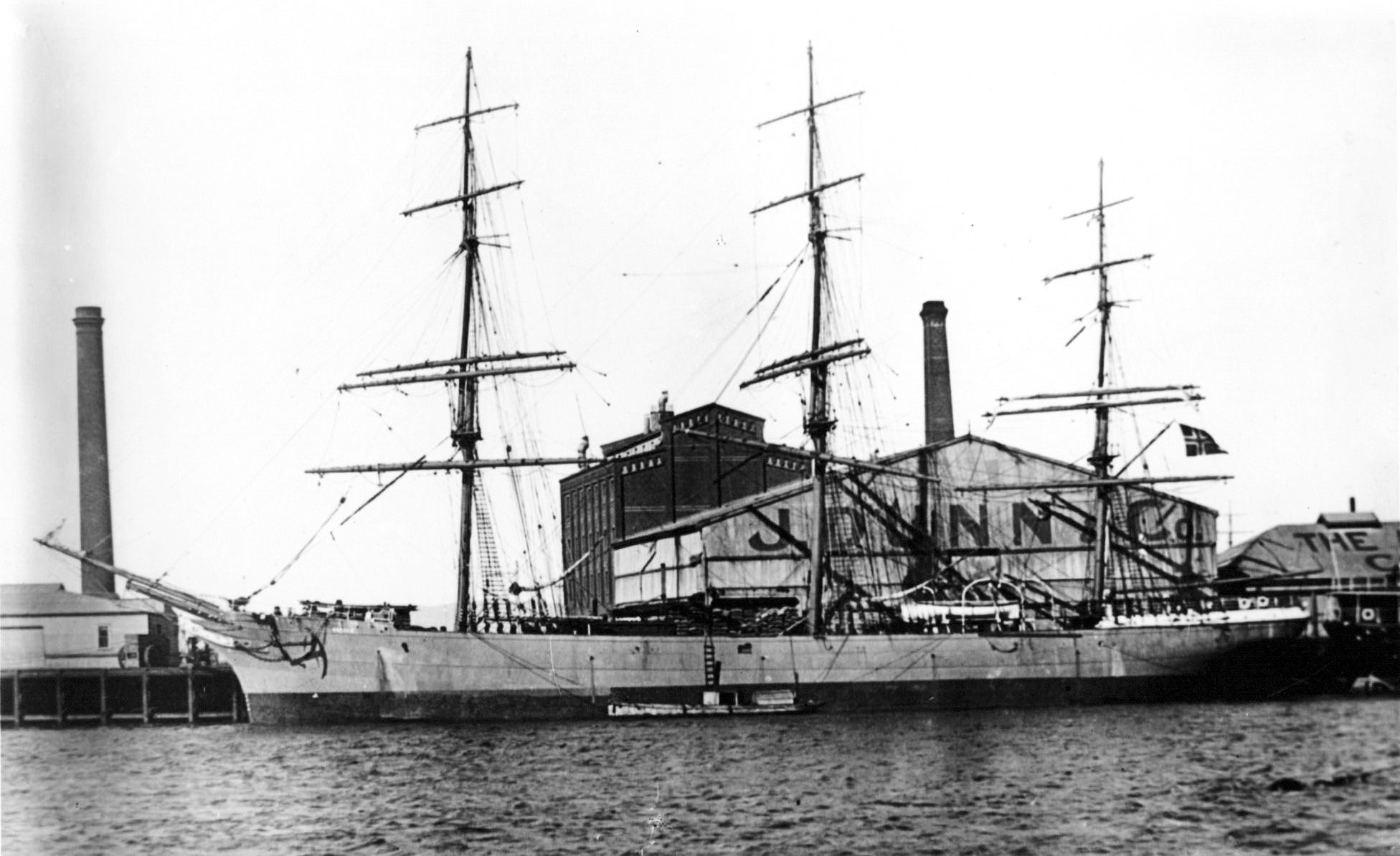
The iron sailing ship Duncan Coupland was launched in November 1877 from the yard of Thomas Royden and Son, Liverpool (Yard No 188). She measured 233.7′ x 37.9′ x 22.9′ and had a net tonnage of 1435 tons. She changed ownership and name to Hornby Castle in 1886 when she was purchased by the Lancashire Shipping Company of Liverpool. Following further changes of ownership in 1905 and 1909 she became the Harald under her final owners Aas & Cappelen of Fredrikstad, Norway.
![]()
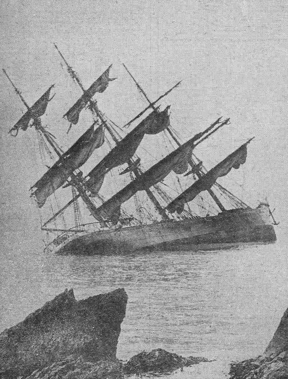
The Harald was en route from Cardiff to Sandefjord in ballast, under the command of Captain Aas with a crew of twenty plus the captain’s wife and child, when she ran aground on the Mull of Oa in thick fog at 6pm on August 15th, 1909. She ran onto the rocks two hundred yards west of Rubha nan Leacan and stuck fast with a heavy list to port, exposing her hatches to the open sea. The crew and passengers made it safely to the shore and the following morning reached Port Ellen to report the fate of their ship.
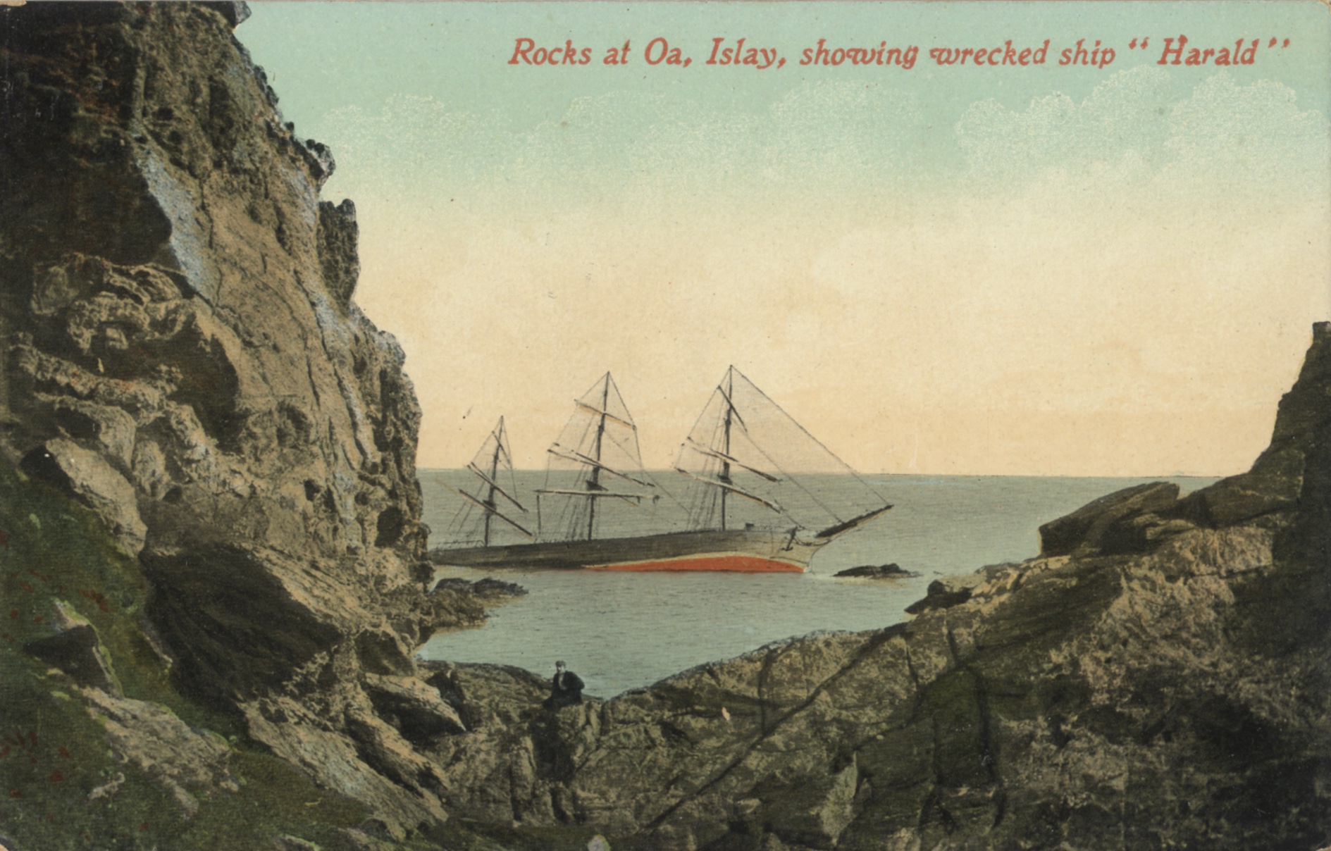
At first it was hoped that she might be refloated but her position was very exposed and it was clear that, if the weather deteriorated, she was doomed. After two weeks work the worst happened when the weather turned – she was abandoned as a total loss on August 30th. The hulk was later sold where she lay and heavily salvaged in situ.
The extensive remains of the Harald lie in position 55°34.702’N, 006°16.388’W (GPS) which is 200 hundred metres west of Rubha nan Leacan. The site is easily located as her sunken bow lies a few metres south east of a prominent shark fin shaped rock which is visible at all states of the tide.
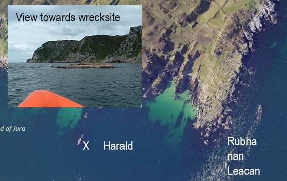
The wreck lies on a north east, south west orientation with her bow section rising some six metres from the seabed at ten metres and the rest of the wreck is spread over a wide area in depths from 3 to 11 metres. There is no tide on the wreck itself but the site is very exposed to the prevailing wind and swell and would be completely undiveable in anything other than calm weather. The tide rip off Rubha nan Leacan has to be seen to be believed and requires very careful boat handling to negotiate as short steep waves rear up unexpectedly in front of the boat and could easily overturn even the most robust small craft. If approaching the site from Port Ellen keep close in shore as you pass the headland and you will miss the worst of it.


