Introduction
Scotland, lying as it does in the north east Atlantic almost completely surrounded by water with prevailing south west winds driving shipping towards it’s shores, has throughout history been inextricably linked to the sea. Indeed, the Scots themselves, arrived in the country from across the sea in Ireland. From the earliest times the country, particularly in the north, became a crossroads for trade and travel from Europe. Archeological evidence in Orkney and Shetland indicates people living in sophisticated villages at least 6000 years ago and has uncovered items there that show these people were trading with neighbours in Scandanavia and Europe during these prehistory times.
The territorial extent of Scotland as it exists today was established by treaty with England in 1237 and by treaty with Norway in 1266. The islands of Orkney and Shetland finally became part of Scotland in a second agreement with Norway in 1472. The small country has a massive coastline indented with hundreds of sea lochs and off shore islands. Some sources quote at least 950 islands round the coast. The coastline is estimated at almost 10,000 kilometres with it’s only land border (with England) consisting of less than 100 kilometres.
The resultant dependence of sea travel instigated a shipbuilding industry which prospered on many of the main rivers around the country particularly on the River Clyde and River Forth although other areas including on the Tay and at Aberdeen on the east coast also built and launched many vessels. The reputation of Scottish shipbuilding and especially the activity on the Clyde spread worldwide… even today the term Clydebuilt is understood globally to describe quality in construction. Sadly the industry has declined in recent years as competition from the Far East drove the yards in Scotland out of business. In the second half of the 19th century and the early years of the 20th century a huge fleet of steamships emerged shuttling between the islands and up and down the various river deltas carrying goods and passengers to the communities living there.
During both World Wars the strategic location of Scotland at the crossroads between the North Atlantic trading routes, the North Sea and the countries of Europe made it a battleground for Allied and German forces with hundreds of ships attacked and lost to German U-boats and mines laid around the coast. The vital Transatlantic convoy routes converged on Scottish waters and, although thousands of ship’s made it safely to port, many others were lost as they neared their destinations on the British west coast. This same strategic position meant that Britain’s wartime fleet was predominantly based in Scotland with it’s primary base in Scapa Flow in Orkney.
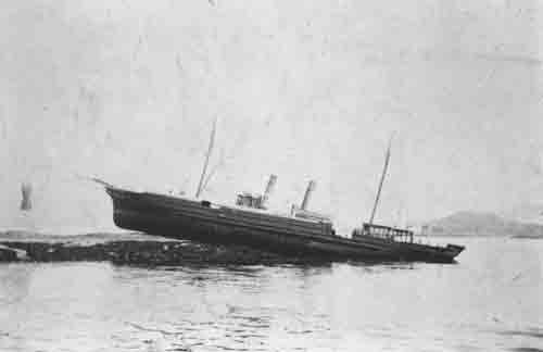
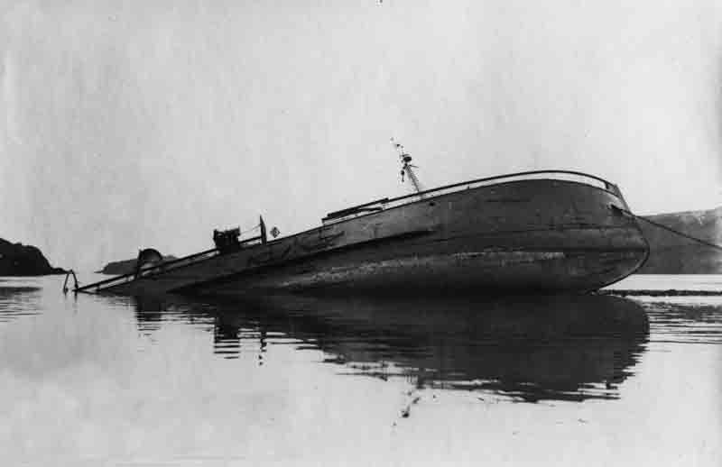
Predictably, the country also developed a massive fishing industry with every town and village around the country’s coast home to their own fishing fleet. Particularly in the late 19th century the introduction of fishing trawlers and the expansion of the rail network, opening up markets throughout Britain, led to a huge boom in the number of fishing vessels based around the Scottish coast. Unfortunately, the industry. interrupted by both World Wars. went into an irreversible decline and, although still important to the Scottish economy today, the fishing fleet in modern times is only a fraction of the size of the fleet in the peak years round the turn of the century. Given the unpredictable weather, the strong tidal streams on many parts of the coast and the complex underwater geography many of these fishing vessels were to meet an untimely end and hundreds of unfortunate fishermen were to lose their lives as the vessels stranded and foundered off the Scottish coast.
The underwater legacy of this maritime history is a vast array of shipwrecks. Records show over 15,000 vessels have been lost round the countries shores – stranded on the rocky coasts, foundered in bad weather and unpredictable tidal streams and sunk by enemy action in the two World Wars of the 20th century. The advent of Scuba diving equipment in the 1970s and 1980s opened the door to discovery and exploration of these shipwrecks. Technical developments in diving equipment over the following 40 or 50 years, with advent of mixed gas diving, mean that wrecks now as deep as 100 metres are being opened up to the more adventurous underwater explorers. This website seeks to provide a window into this interesting and largely unknown feature of Scottish history.
While every effort has been made to establish the exact details of each ship and incident, it is impossible to guarantee the exact accuracy of every detail as the records of many are vague or misleading. The authors have visited the sites of all of the major wrecks included making this the most complete and accurate record of the dive sites in this area ever written. Where possible the positions given have been established using the GPS satellite location system and are indicated as such. We hope you enjoy the book as much as we have enjoyed researching it!
Area Map
Area List
4 NW Scotland & Outer Hebrides


