Although completed after the end of World War I the steel steam drifter Green Sea was built to the order of the Admiralty. She was launched from the yard of Colby Brothers at Oulton Broad, Lowestoft (Yard No 100) on 11th March 1919. She measured 86.2′ x 18.5′ x 9.3′ and her tonnage was 95 gross tons, 40 net tons. She was powered by a triple expansion steam engine by Pollitt and Wigzel, Sowerby Bridge delivering 42 registered horse power. The vessel’s official number was 144800.
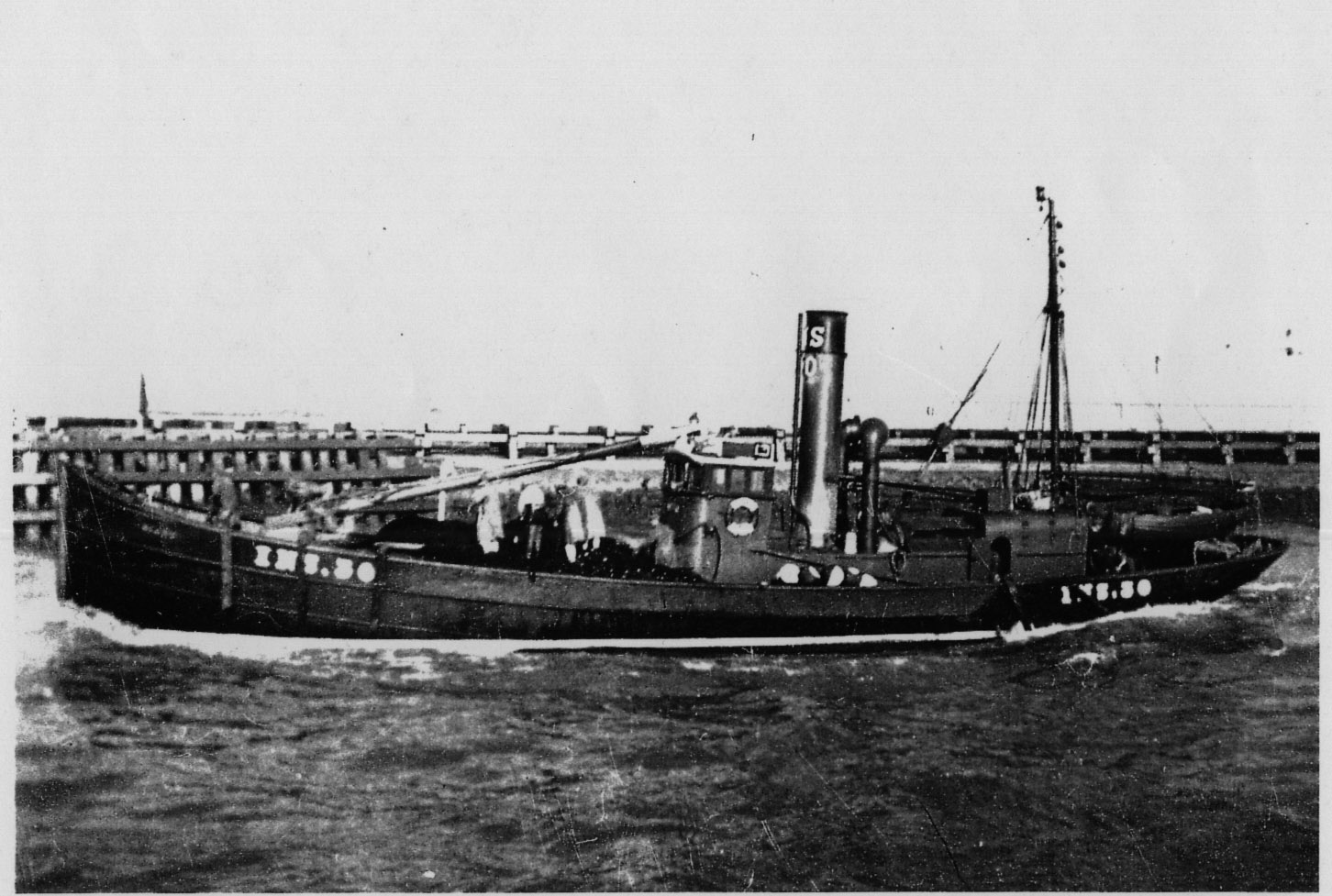
Steam drifter Riant under way
Later the same year she was sold to the Fisheries Board for Scotland who sold her on to Edgar Mutton of Torry, Aberdeen. She was re-named Gladys & Violet and registered in Aberdeen A639. In 1924 she was sold to David Main of Burghead who re-named her Riant and registered her at Inverness INS 30. At the outbreak of World War II she was requisitioned by the Admiralty for war service as a minesweeper.
In January 1940 Riant was based on the Clyde when the skipper received orders to proceed to Oban to a new station. On 26th January she left the sheltered anchorage of Lamlash Bay and proceeded on her journey north. During her voyage west to round the Mull of Kintyre weather conditions began to deteriorate with strong north westerly winds and worsening sea state. During the afternoon, while punching into a head sea, the engineer reported that water was gathering in the engine room bilge and increasing in depth and that the pumps were not keeping pace. The skipper, George Kersey RNR, decided to head for the lea off the south shore of Islay and anchored up off Otter Rock south of Port Ellen where they spent the night.
By 08.00 the following day the weather had abated and the water cleared from the bilges so they proceeded on their journey. Unfortunately it was not long before the water level below deck began to rise again. Instead of heading north through the Sound of Islay they headed for the Isle of Gigha intending to make a more detailed inspection in a safe anchorage. When about 2 miles west of Gigha, with the water continuing to rise, her port rail was almost submerged and her stern was awash. Skipper Kersey took the decision to abandon ship and the crew quickly launched the ship’s boat and cleared away from their sinking ship. It took the crew over two hours to make landfall on the west side of Gigha by which time the Riant had foundered off the north side of Carraig Mhor.
The wreck of the Riant lies approximately 0.5 miles west of Carraig Mhor off the west side of Gigha in position 55°40.303’N, 005°46.926’W (GPS). The wreck lies on the south side of a reef in general seabed depths of 35-37 metres with least depth over the wreck of 32-33 metres.
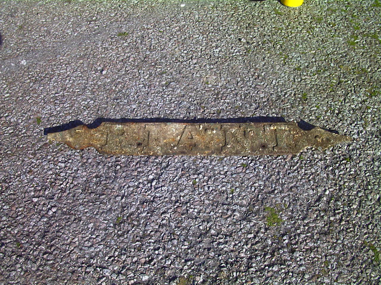
Riant nameplate recovered from wreck
She sits upright canted over to her port side. In recent years she has started to collapse, the result of a hit by a scallop trawler. Her stern has fallen away, the deck has dropped around 1.5 metres and the bow is bent back on itself. She lies, facing west, on a gently sloping rock and boulder seabed. The reef to the north shields her from the worst of the weather and sea conditions but can be confused with the wreck on an echo sounder.


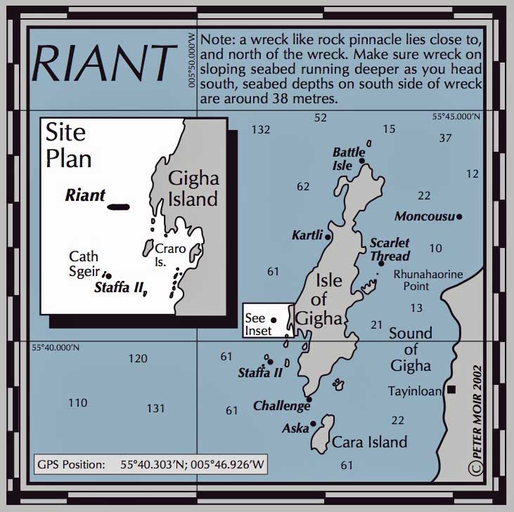
Location chart
Emblem from a pottery chard


