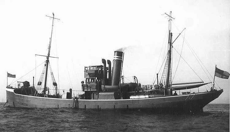
The Trygon was a steel steam trawler built by Cook Welton & Gemmell at Beverley (Yard No. 167) and launched on 30th June 1908. She was owned by the Mount Steam Fishing Company of Fleetwood (FD 221) and remained in their ownership until shortly after the outbreak of the First World War. She measured 130.0′ x 23.0′ x 12.2′ and her tonnage was 289 gross tons, 141 net tons. She was powered by a triple expansion steam engine by Amos and Smith Ltd delivering 88 registered horse power.

GA drawings for same class of vessel
Picture of a similar ADM trawler
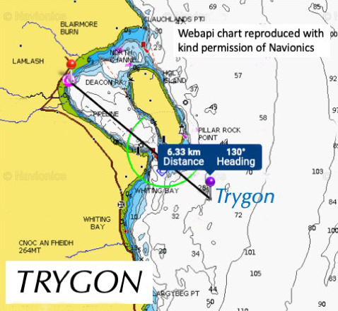
In 1915 she was requisitioned for war service by the Royal Navy and arrived at Devonport in February for her fit out as a auxiliary patrol vessel – FY 978. The Trygon was deployed in March 1915 and was stationed on the Clyde commanded by skipper Percy Jennings RNR. Her service career was extremely brief as she was fatally damaged during a collision with the Glasgow based steamship Myrtle Grove on 30th March 1915. Fortunately, there was no loss of live, however the Trygon sank off Whiting Bay, Isle of Arran in around 30 fathoms of water.
The wreck of the Trygon lies in position 55°29.783’N 005°02.767’W, approximately 3 km east of Whiting Bay and 2km south south-east of Holy Isle. The wreck lies on the east side of a shelving bank with depths ranging between 54 to 61 metres.
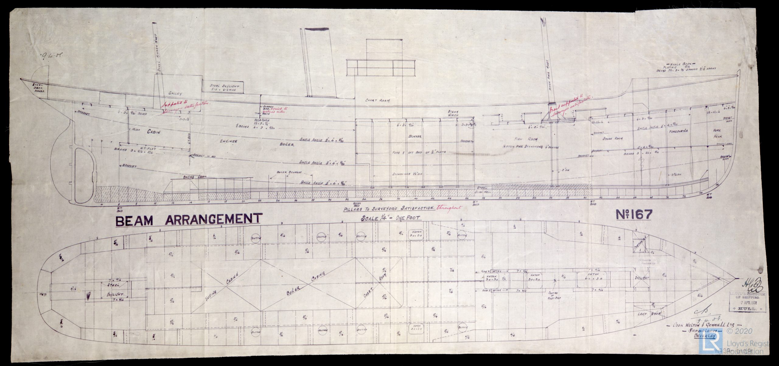
Builders GA drawing of Trygon – Lloyds Register
The wreck rises between 3-4 metres above the surrounding seabed and sits with an east/west orientation with bows pointing towards Whiting Bay. The shallowest part of the wreck is the foc’sle where a small gun can be seen, still pointing forward. Most of the superstructure midships has fallen away to port and forward into the main fish hold. The engine room area is open and the boiler and engine are clearly visible. The stern area appears to be most degraded and is likely to have been the area of the collision with the Myrtle Grove. The propeller and rudder are still in place.
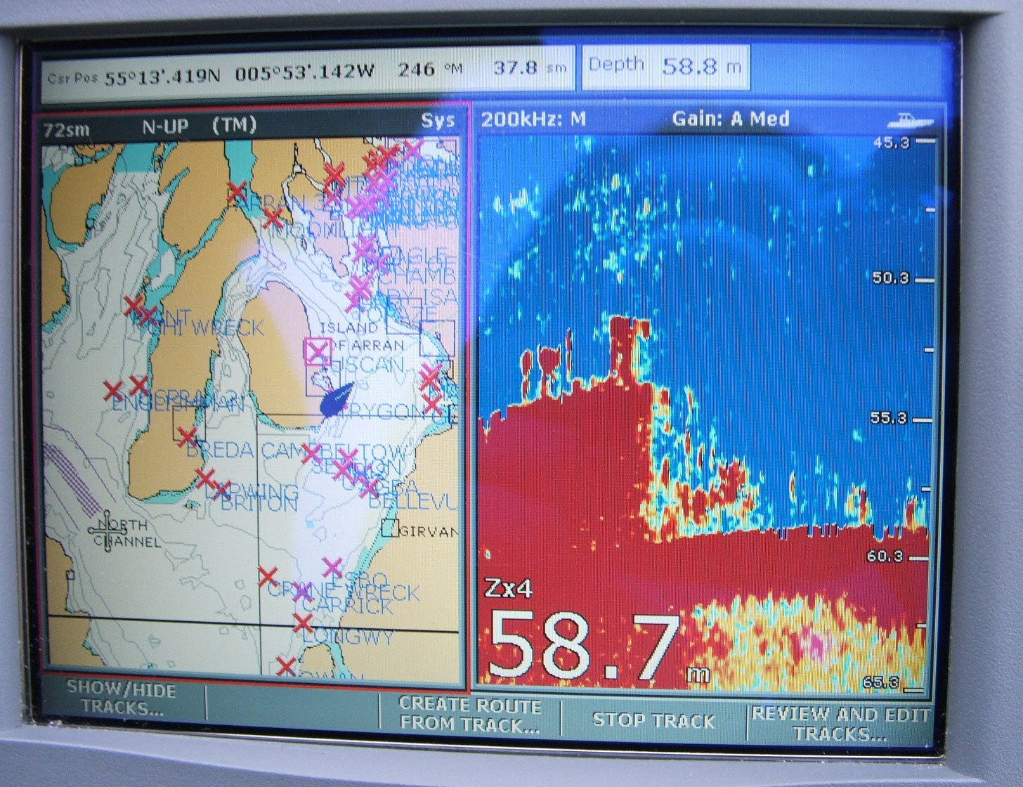
Sonar view of bow.
Care should be taken when diving this wreck as there a number of ropes and pieces of net attached to the wreck at deck level. The visibility and light levels have been found to be generally good at 4-5 metres on average. She is probably best dived on high water. Launch points from the mainland are Troon or Largs and Lamlash on the Isle of Arran.
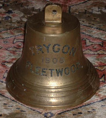
Bell recovered from wreck
We would like to thank Naomi Watson for allowing us to reproduce her underwater photographs of the wreck, which are reproduced below.


